Document
Document
File Name
Les_oiseaux_reserve_Sidi-Boughaba_p67-99_Bul-In-Sc_n1-1976.pdfFile Type
PDF DocumentFile Size
3.36 MBCreated Date
2022 Feb 09Updated Date
2022 Feb 09Published on
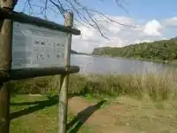
2022 Feb 09Lake Sidi Boughaba
The “Sidi Bou Ghaba Biological Reserve” of 150 ha concerning the wetland in the strict sense from its extreme southern limit to the level of the current building of the National Environmental Education Center (CNEE) .The 652 ha “Forest Canton of Sidi Bou Ghaba” of 652 ha, including the Biological Reserve in addition to a national forest. The boundaries of the Canton are to the south, the Marabout of Sidi Bou Ghaba, to the west, the Atlantic Ocean, to the north, the Kasbah of Mehdia and to the east, the collective lands and the forest of Mamora.
The “Classified Site” (Order of the Ministry of Cultural Affairs, 1951). The area of the classified site includes, in addition to that of the Canton Forestier, an area estimated at 150 ha composed, to the south, of planted dunes and collective land to the north. Overall, the SIBE is limited to the north by the mouth of the Oued Sebou, to the south by the Marabout of Sidi Bou Ghaba, to the west by the seaside resort of Mehdia and the Atlantic Ocean and to the east by agricultural land and the forest of Mamora.
“Forest Canton of Sidi Bou Ghaba”, administrative delimitation in 1916, area of 652 ha.” Site classified”, as a natural and cultural site, in 1951 by order of the Ministry of Cultural Affairs (Department of Historic Monuments and Sites), area of 802 ha (652 ha + 150 ha).” Area of International Importance for Waterbirds” recognized by BIROE in 1964.” Biological Reserve”, in 1974 by the Water and Forests and Soil Conservation Administration, area of 150 ha. Site included in 1980 on the “Ramsar” list relating to wetlands of international importance as waterbird habitat.
SIBE data sheet
1. LOCALIZATION
1.1- Coordinates: 34° 15' N - 06° 39' W
1.2- Map references: 1/50.000 - KENITRA, SIDI BOU QNADEL
1.3- Administrative province: Kenitra
1.4- Near administrative center: Mehdia 1.5- Near administrative center: Mehdia
1.5- Forest district: Kenitra 1.5- Forest district: Kenitra 1.6- Biogeographical region: n°3 - MAMORA Littoral
2.AREA and LIMITS
2.1-Proposed area: 800 ha
2.2- Proposed limits:
- The “Sidi Bou Ghaba Biological Reserve” of 150 ha concerning the wetland in the strict sense from its extreme southern limit to the level of the current building of the National Environmental Education Center (CNEE) .The 652 ha “Forest Canton of Sidi Bou Ghaba” of 652 ha, including the Biological Reserve in addition to a national forest. The boundaries of the Canton are to the south, the Marabout of Sidi Bou Ghaba, to the west, the Atlantic Ocean, to the north, the Kasbah of Mehdia and to the east, the collective lands and the forest of Mamora.The “Classified Site” (Order of the Ministry of Cultural Affairs, 1951). The area of the classified site includes, in addition to that of the Canton Forestier, an area estimated at 150 ha composed, to the south, of planted dunes and collective land to the north.
- Overall, the SIBE is limited to the north by the mouth of the Oued Sebou, to the south by the Marabout of Sidi Bou Ghaba, to the west by the seaside resort of Mehdia and the Atlantic Ocean and to the east by agricultural land and the forest of Mamora.
3. CURRENT STATUS
3.1- Land System: Private State Domain, Public Domain, Public, Collective, Private and Habous
3.2- Uses: None 3.2- Various:
- “Forest Canton of Sidi Bou Ghaba”, administrative delimitation in 1916, area of 652 ha.” Site classified”, as a natural and cultural site, in 1951 by order of the Ministry of Cultural Affairs (Department of Historic Monuments and Sites), area of 802 ha (652 ha + 150 ha).” Area of International Importance for Waterbirds” recognized by BIROE in 1964.” Biological Reserve”, in 1974 by the Water and Forests and Soil Conservation Administration, area of 150 ha. Site registered, in 1980, on the “Ramsar” list relating to wetlands of international importance as a habitat for waterbirds.
- Creation of the National Center for Environmental Education in 1992 within the Site.
4. BIOCLIMATES AND PHYSICAL ENVIRONMENT
4.1-Bioclimatic Characteristics: Warm Subhumid Thermomedrean 4.2-Physical Characteristics:
- Submerged depression located one kilometer from the Atlantic coast between two dune cords. To the west, unconsolidated, white dunes with raw mineral soil and limestone infill sand and fixed gray dunes formed of sandy rendzine. Orientation NNE-SSW, its length is nearly 6 km, its width is 100 to 350 m. The depth varies from 0.5 to 2.5 m. The waters of the Merja come from the groundwater table (topographic surface below the piezometric level) and from precipitation. There is no communication with ocean waters or with salt groundwater.
- Merja water is highly mineralized, the salinity varies during the year, it is a function of the variation in the volume of water. It is alkaline water, its pH is always close to 9. The extreme temperatures of water are 15° and 34°C. It is rich in chlorides, organic matter and magnesium ions.
5. BIOECOLOGICAL QUALITIES
5.1- Flora and vegetation:
- Algual vegetation is formed in the shallow parts of the Merja by a benthic population of characeae. In the deep part, a few populations with a high abundance of phytoplankton are developing. The hygrophilous vegetation of the borders of the merja and areas of seasonal emergence and immersion consists essentially of Cyperaceae and Juncaceae mixed, sometimes with Phragmite. Typha appears in the shoals in the company of temporary annual Chenopodiacean vegetation at the beginning of summer. The watersheds of the Merja are occupied by terrestrial vegetation in the climacic state of red juniper. This wetland is, moreover, the last shred of the entire coastal zone of Gharb where this climatic vegetation, which was previously widespread, still persists. In the degraded areas, a matorral develops in Retama monosperma. Other species such as Oleaster, Lentisk, Asparagus, Lavender, Tamarix, Fern, to name only these species, are part of the composition of the plant formations of this site.
- Three exotic species have been introduced into the reserve, the Acacia trees planted by the Water and Forests Administration to fix the mobile dunes on a 30-ha coastal strip, an Eucalyptus plantation along the road and in the picnic area, a few poplar trees on the edge of the lake next to the picnic area.
Listed in Junipéraie which occupies all the dunes:
| Species | Frequency | Species | Frequency |
| Juniperus phoenica Clematis cirrhosa Ephedra fragilis Pistacia lentiscus Phillyrea media Olea sylvestris Rubia longifolia Arisarum vulgare Rhamnus oleoides Prasium fragilis Prasium majus Jasminum fruticans Osyris quadripartita |
V V IV V V V V V V V IV III II II |
Chamaerops humilis Asparagus albus Smilax aspera ssp. mauritanica Geranium purpureum Parietaria mauritanica Mercurialis annua Centaurea seridis Urtica membranacea Phagnalon saxatile Membranacea Phagnalon saxatile Retama monosperma Retama monosperma Calamintha ascendens Diplotaxis catholica Lotus arenarius |
II II I V V V V V IV IV IV III III III II |
5.2- Animal fauna and population:
The Bou Ghaba site lake is home to a diverse population of Zooplankton and aquatic invertebrates. Several species of dragonflies can be observed hunting close to the surface of the water. Being located near the Mamora forest, the site of Sidi Bou Ghaba is a refuge for a certain number of species of Amphibians, Reptiles and Mammals. Given its location on the Palearctic-Sub-Saharan Africa migration axis, the Sidi Bou Ghaba site constitutes one of the most important wetlands on the Moroccan Atlantic coast for waterbirds and represents a resting and feeding area for migratory or wintering birds. More than half of the birdlife that frequents the country can be observed at the site level Over the past five years, an average of 4000 Anatidae winter there. Almost all species of Anatidae can be encountered during migration or wintering. It should be noted that Sidi Bou Ghaba is the main wintering site for marbled Teal at the Palearctic scale.
Thirty species are nesting species, the most remarkable and of international importance are the Marbled Teal, the Crested Coot, the Night Heron and the Cape Owl.
5.3- Ecosystems and environments:
- Freshwater coastal merja (permanent, semi-permanent and temporary environment), Natural forest on the slopes, Reforestation formations (Eucalyptus & Acacia). - Aquatic vegetation: rich and diverse in the process of invading all of Merja (since the reservation was made) - Waterfront vegetation: rich and diverse. Ecosystem in Juniperus after conservation: very dynamic, in the process of fixing living dunes following the reforestation operation for biological stabilization.
- One of the most exceptional wildlife processions in Morocco (mainly for birdlife).